

Hiking in Berlin and the surrounding area
The most beautiful routes, from the city centre to Brandenburg
With extensive forests and lakes, you will find an abundance of opportunities for local recreation in Berlin. We would like to show you how you can discover the green side of the city on Berlin's hiking trails. Lace up your hiking boots and look forward to idyllic, interesting and surprising hikes in and around Berlin!
Havelhöhenwanderweg (Havel Heights Trail)
Getting there and information:
- Bus | M49 (Stössenseebrücke)
- S-Bahn | S3, S9 (Pichelsberg)
- Start and finish: Heerstrasse (Charlottenburg) – Strandbad Wannsee open-air lido (Zehlendorf)
- Length: approx. 10 km
- Duration: approx. 4-5 hours
- Difficulty: easy
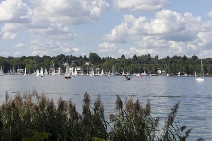
The Havelhöhenweg trail runs along the Havel from Pichelsberg to the south through Grunewald to the Strandbad Wannsee open-air lido. In addition to the scenic attractions, the highlights of the trail include the 55-metre-high Grunewald Tower, the forest exhibition "Wald.Berlin.Klima" ("Forest.Berlin.Climate"), the Schildhorn Monument and the idyllic Havel island of Lindwerder. On top of the Grunewald Tower there is a viewing platform offering a beautiful view. At the end of the hike you can relax and cool off in the Strandbad Wannsee.
The Wuhletal Hiking Trail

Getting there and information:
- Bus | 197, 390, 901, N97 (Ahrensfelde)
- S-Bahn | S7 (Ahrensfelde)
- Tram | 16, M8 (Ahrensfelde/city limits)
- Start and end: Eichepark (Marzahn) – Köpenick S-Bahn station (Köpenick)
- Length: approx. 15 km
- Duration: approx. 4.5 hours
- Difficulty: easy
A half-day hike through nature, in the heart of the city – no less than that is offered by the Wuhletal Hiking Trail, which winds its way from Eichepark at the Ahrensfelde S-Bahn station with the valley of the Wuhle to the south to the Köpenick S-Bahn station. For those not wishing to walk the entire trail, the Wuhletal S-Bahn station at about half way is a good starting or finishing point. Besides the biodiverse, idyllic river valley itself, you will encounter numerous parks and meadows along the way. The route also runs along the grounds of the International Garden Exhibition, where you can take a short detour on a cable car ride.
Panke Hiking Trail

Getting there and information:
- S-Bahn | S2 (Bernau)
- Regional Express | RE3 (Bernau)
- Start and finish: S-Bahn station Bernau (Bernau bei Berlin) – U-Bahn Reinickendorfer Strasse
- Length: approx. 26 km
- Duration: approx. 7-8 hours
- Difficulty: moderate
From Bernau in Brandenburg, the Panke flows right across Berlin's north-east almost all the way to Central Station – a somewhat challenging but all the more interesting route due to its length. You start in the tranquil Bernau, outside the Berlin city limits, and then walk past ever-changing panoramas to the heart of the city centre. Of course, you can also start the hike from the Spree in the direction of Bernau or walk only part of the trail. The Karow S-Bahn station halfway along the route is an ideal place to start or finish.
Tegeler Fliess

Getting there and information:
- Bus | 222, N22 (Alt-Lübars)
- Start and finish: Alt-Lübars (Reinickendorf) – Schloss Tegel (Tegel Palace)
- Length: approx. 8 km
- Duration: approx. 2-3 hours
- Difficulty: moderate
The hike takes you from idyllic Alt-Lübars, the oldest village in Berlin, along the Tegeler Fliess downstream to Schloss Tegel on Lake Tegel. On the way you will encounter numerous enchanting natural landscapes and wetlands, such as the Lübarser Felder nature reserve, and even exotic water buffalo. The Hermsdorfer See, through which the Tegeler Fliess flows, is also on your way. At the end of the hike you can take a walk through the Schlosspark Tegel.
Lake Schlachtensee

Getting there and information:
- S-Bahn | S1 (Schlachtensee)
- Start and finish: Schlachtensee S-Bahn station
- Length: approx. 6 km
- Duration: approx. 1-2 hours
- Difficulty: easy
On a tour around the Schlachtensee in the south-west of the city, you can combine hiking in Berlin with an occasional plunge into the water to cool off. The route takes you from the Schlachtensee S-Bahn station once clockwise around the city's elongated lake. Along the shady shore path, covered with thick greenery, you will find numerous idyllic small sunbathing lawns and natural bathing areas.
Lakeside hiking trail at Müggelsee

Getting there and information:
- S-Bahn | S3 (Friedrichshagen)
- Tram | 60, 61 (Müggelseedamm/Bölschestrasse)
- Start and finish: Spreetunnel Friedrichshagen – S-Bahn station Wilhelmshagen
- Length: approx. 15 km
- Duration: approx. 5 hours
- Difficulty: moderate
The somewhat longer, but all the more beautiful hike takes you to the south-east of Berlin: you first walk down the busy Bölschestrasse from the Friedrichshagen S-Bahn station until you discover the Spreetunnel. There you cross under the Spree and follow the idyllic lakeside hiking trail on the southern shore of the Grosser Müggelseesee to the Müggelspreewiesen nature reserve. Behind the extensive landscape conservation area, a special highlight awaits you: Neu-Venedig (New Venice), which is criss-crossed by numerous picturesque canals. From there it is only a short way to the Wilhelmshagen S-Bahn station.
Drachenberg in Grunewald

Getting there and information:
- S-Bahn | S3, S5, S7, S75 (Grunewald)
- Start and finish: S-Bahn Grunewald
- Length: approx. 6.5 km
- Duration: approx. 2 hours
- Difficulty: moderate
The hilly hike through the Grunewald forest offers slightly more gradient than many other hikes in Berlin. More than 100 metres of difference in altitude have to be overcome in total. You first walk from Grunewald S-Bahn station to Teufelsseechaussee, then walk anti-clockwise over the two hills and back to the station. From Teufelsseechaussee you first climb the Drachenberg and are rewarded with an excellent view. From there the hike continues to the Teufelsberg. On its summit, a picturesque panorama awaits you with its old, abandoned listening installation. To get back to the S-Bahn station, you will then walk along Teufelsseechaussee once more.
Berlin wall trail

Getting there and information:
- Bus I 100, 147, M41, M85
- S-Bahn I S1, S2, S25, S26
- Start and finish: Brandenburg Gate
- Length: approx. 164 km
- Duration: approx. 38 hours
- Difficulty: medium
The Berlin Wall Trail stretches along the approx. 160 kilometre long former border between the GDR and West Berlin. The trail takes you once across the capital and takes you on a journey to learn about the history of the once-divided city. The route combines sections close to nature and places of historical interest. You will not only pass the former border crossing at Invalidenstraße or the Palace of Tears, but can also make a stop at Potsdamer Platz and Checkpoint Charlie. Due to its length, the Berlin Wall Trail is also ideal for a multi-day hike or bike tour.
Liepnitzsee circular hiking trail

Getting there and information:
- Regional train | RB27 (Wandlitz, Wandlitzsee station)
- Start and finish: Bernau, Wandlitzsee station
- Length: approx. 14 km
- Duration: approx. 5 hours
- Difficulty: moderate
The extensive hike leads from Wandlitzsee station in Wandlitz, Brandenburg, first to Liepnitzsee and then clockwise around it. On the way you have the possibility to take the ferry from the lakeside to the Grosser Werder, a green island in the lake. You can also plunge into the cool water at various bathing spots. One of the scenic highlights is Oberseemoor on the eastern shore of the lake.
From S-Bahn Wannsee toPotsdam

Getting there and information:
- S-Bahn | S1, S7 (Wannsee)
- Start and finish: Wannsee S-Bahn station – Potsdam Central Station
- Length: approx. 15 km
- Duration: approx. 3-4 hours
- Difficulty: moderate
The relatively long route from the Wannsee S-Bahn station in a westerly direction to Potsdam's main railway station boasts many scenic and historical highlights. The hike starts in Berlin, heading out from the Wannsee S-Bahn station to the south-west. On the way you will cross the Westlicher Düppeler Forst bird sanctuary before continuing to the Griebnitzsee lake. There the hike continues towards the city limits until you reach the Glienicke Bridge: At the former border crossing you enter Potsdam. Walk south through the New Garden in the Nauener Vorstadt to the Dutch Quarter with its striking houses. A little further south from there your destination, Potsdam Central Station, is already waiting for you.


